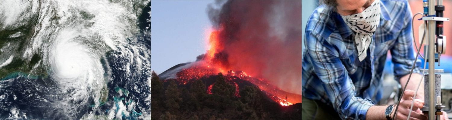
To give you a flavor of the types of projects students have completed in CorGGLE, here are some examples. Each CorGGLE student completes a research project guided by faculty, research staff, and graduate students and presents the work at an end of the summer symposium. Projects change every year.
TITLE: Correlations Between Stratospheric Polar Vortex Waves and Cold Air Outbreaks Over North America with Applications to a Simple Coupled Dynamical Model
Student: Sheryar Choudhry; Advisors: Drs. Peter Hitchcock and Art DeGaetano
ABSTRACT
 In recent decades, severe cold weather events in the United States have been devastating for regions ill-equipped to handle them – one case being the cold snap in Texas in February of 2021. Most of these events can be attributed to Cold Air Outbreaks (CAO) which have been linked to variability in the Stratospheric Polar Vortex. More specifically, it is theorized that slowdowns in the Polar Vortex phase speed may lead to resonance between the Stratospheric and Tropospheric layers causing anomalous weather. Our goal is to observe the characteristics between CAOs over the continental US and planetary-scale wave activity in the stratosphere at 60°N to better forecast severe cold weather events. CAO events are found using daily averaged 3-hour 2m temperature standardized anomalies during the extended winter season (October-April) from 1940 to 2022. We perform Fourier analysis to analyze the wave amplitudes, phases, and phase speeds for 10hpa and 100hpa geopotential heights during the CAOs to find any correlations with the stratosphere. Furthermore, we adapt a previously derived simplified dynamical model to describe the coupling planetary-scale waves in the stratosphere and troposphere. The model is composed of two layers which are coupled using the planetary wave speed. We briefly examine our model for any similar characteristics.
TITLE: InSAR-derived changes in ground deformation at East Mesa Geothermal Complex, Imperial Valley California
Student: Jesus Plata II; Advisors: Dr. Rowena Lohman and Olivia Paschall
 ABSTRACT
Interferometric Synthetic Aperture Radar (InSAR) is an imaging remote sensing technique first used for research in the late 1970s with NASA’s Seasat mission. In the geosciences, it is often used to study the deformation of the Earth’s surface, quantifying near-vertical displacement with up to mm-scale precision over large surface areas. In this study, we used InSAR to analyze the ground deformation surrounding the Ormat East Mesa geothermal complex, located in the Imperial Valley, Southern California. The complex consists of a group of power plants with a generating capacity of 39 MW and began commercial operation between 1987-1989. The East Mesa complex is of particular interest due to its proximity to the All- American Canal System, the largest irrigation canal in the world. A connecting canal, the East Highline Canal, sits ~2 km west
of the geothermal field, and its operation can be affected by cm-scale surface displacements. Previous studies from 2006– 2010 and 2015–2019 show peak uplift rates of 0.9 cm/yr and peak subsidence rates of 2 cm/yr and 1 cm/yr, respectively. We used 210 SAR acquisitions between May 2017 and January 2022 to create 209 interferograms. We found that spatial patterns of deformation agree with previous studies: the western portion of the desert shows subsidence, while the eastern part shows uplift. Our analysis shows peak uplift and subsidence rates of 2.07 and 4.07 cm/yr, respectively. Though these rates are larger than previous studies, further inspection shows rates between our time period of 2017-2019 agree with the previous study’s period of 2015-2019. Isolating annual velocity maps for the years 2020 and 2021 show greater magnitude uplift and subsidence signals, reaching over 4.5 cm/yr of uplift and 8 cm/yr of subsidence in some areas. A potential explanation for these greater magnitudes is an increase in production during these two years of operation. Examining the reported electricity generation from 2019 to 2020 and 2021 we see an increase of >6%in production from 2019. In conjunction, we also see a decrease in net reinjection to the wells in 2020 and 2021 compared to 2019. These two factors may have contributed to the increased deformation rates of the East Mesa complex. Overall, InSAR is a useful, open-source tool to continue monitoring this region of interest to further understand how geothermal activity affects the Earth’s surface and impacts critical infrastructure like the All-American Canal System.
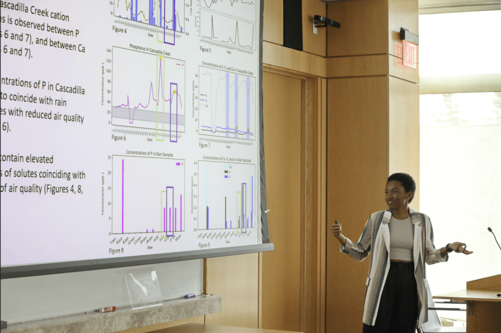
TITLE: Short-term monitoring of Cascadilla Creek’s response to Canadian wildfire smoke
Student: Zoë Gold; Advisors: Dr. Nicole Fernadez and Hunter Jamison
ABSTRACT
Cascadilla Creek is one of the primary rivers which feeds into Cayuga Lake, the second largest of New York’s Finger Lakes. Previous studies identify phosphorus (P) loading from soils as the facilitator of harmful algal blooms (HABs) observed in several of the Finger Lakes in recent years. Preliminary studies suggest increasing rates of P loading could derive from a climate change induced perturbation in the annual rain to snow ratio sourcing waters to regional catchments. Unlike snow, rain events flush biogenic nutrients from shallow soils and introduce these solutes into waterways. In investigating the P levels in Cascadilla Creek, it became necessary to consider an additional P source, wildfire smoke. Particulate matter from wildfire smoke mobilizes nutrients such as phosphorus, sulfur, and zinc. During the month of June, we observed drastic decreases in air quality coinciding with the ongoing Canadian wildland fires. As of July 19th, the fires had burned over 27 million acres, which, compared to the past decade, is more than seven times the average amount of land burned at that point in the season. With expectations for wildfire season to continue into September, wildfire smoke presents a potential enhancer of nutrient loading to lakes and streams. In this study, we performed environmental monitoring to evaluate Cascadilla Creek’s chemical composition shifts and ascertain whether air quality affects overall P loading in the river. Monitoring consisted of daily sampling and flow rate measurements of Cascadilla Creek, rainwater collection, and retrieval of air quality data from PurpleAir sensors. Samples were analyzed for a range of parameters, including biogenic and geogenic solutes, pH, temperature, turbidity, specific conductivity, alkalinity, and stable isotopes. Preliminary results support our expectations that interactions between rain events and smoke particles influence P levels in Cascadilla Creek. Monitoring efforts will continue for the duration of the wildfire season. This study’s results will also help inform ongoing projects aiming to quantify local watershed- scale responses to the changing climate.
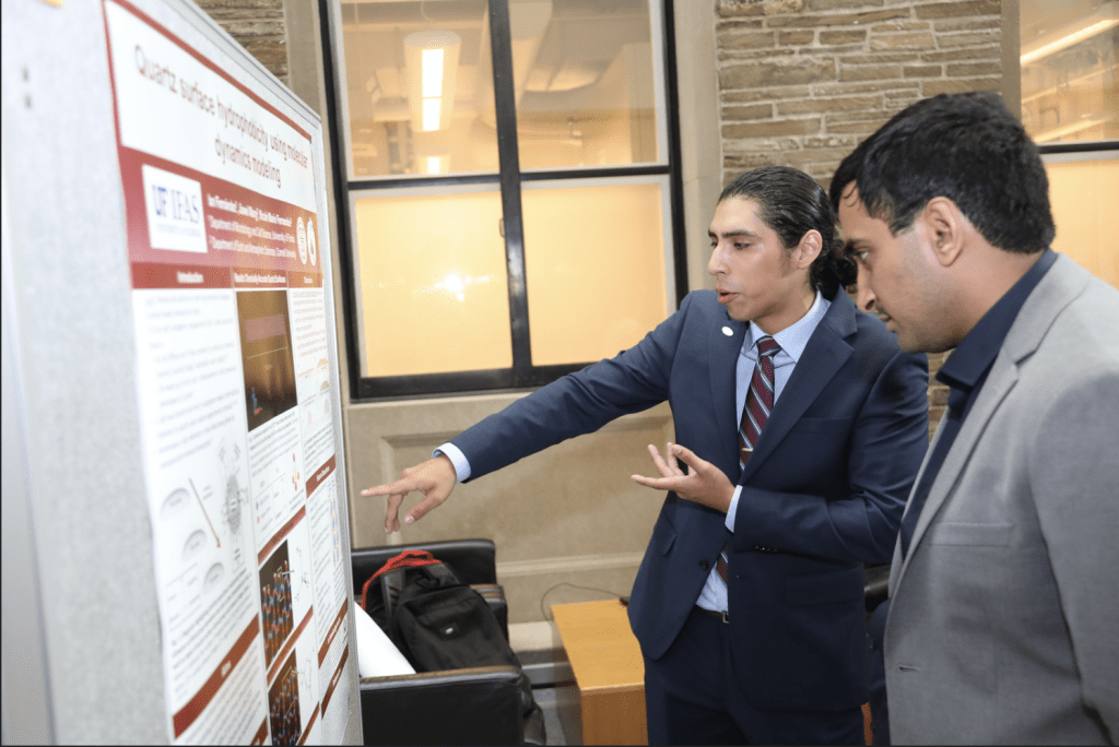
TITLE: Quartz surface hydrophobicity using molecular dynamics modeling
Student: Ian Fernandez; Advisors: Dr. Nicole Fernadez and Jiawei Wang
 ABSTRACT
The goal of this research is to develop and optimize an inert (non-reactive) nanoparticle tracer, due to its characteristic minimal diffusivity, surface characterization potential, and ability to be rapidly transported through porous media, compared to that of chemical tracers. Although our carbogenic (carbon-based) nanoparticle (CN) – synthesized from citric acid and ethanolamine – was found to be inert in sandstone media field experiments, it also demonstrated an anomalous retention behavior on quartz sands (silica-based proxy for sandstone) when tested in the laboratory. Evidence from previous laboratory experiments revealed that CN retention behavior on quartz can be attributed to hydrophobic nanoparticle-mineral interactions. Based on these findings, we hypothesized that increasing the siloxane (Si-O-Si) surficial site abundance on the quartz surface to enhance hydrophobicity will facilitate greater CN retention in an adsorption system. This preliminary study aimed to implement Artificial Intelligence (AI) collaboration tools and Molecular Dynamics (MD) computer modeling techniques to investigate nanoparticle-mineral surface interactions by simulating the adsorption behavior of water molecules on quartz surfaces of three different compositions: 100% siloxane (Si-O-Si), 100% silanol (Si-O-H), and 50% siloxane/50% silanol. The objective of this research is to address the current lack of molecular-scale information regarding the silica interface structure and composition responsible for generating the conditions necessary for hydrophobic interactions to occur. These efforts are projected to generate multiple MD models, built using first principles, for use as reference tools by other geoscience researchers. This work is expected to continue into the next academic year.
TITLE: Comparing Thermal ASTER Data and Air Quality Reports to Identify Pre-Eruptive Passive Degassing at Holocene Volcanoes in South America
Student: Jiada Valenza; Advisors: Dr. Matt Pritchard and Andie Gomez-Patrón
ABSTRACT
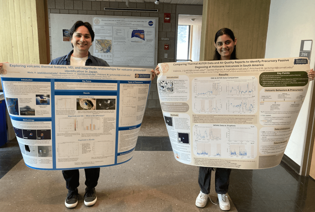 Volcanoes have long been recognized as a source of air pollution, especially within the aviation industry, where volcanic ash clouds are treated as a severe threat and studied through Volcanic Ash Advisory Centers (VAACs) and modeled through the Volcanic Ash Contingency Exercise (VOLCEX) (Hirtl et al., 2020). While the most significant and immediate sources of air pollution from volcanoes come from ash plumes during eruption, pre-eruptive passive degassing is a more prolonged, smaller- scale phenomenon occurring during periods of quiescence. Passive degassing involves the release of magmatic gasses such as SO2 and NO2 from vents on the volcanic surface. While ground-based sensors provide a means of studying passive degassing at the source, such technologies can be dangerous and economically unfeasible, thus leading to the emergence of remote sensing in volcanology. Among the uses of remote sensing at volcanoes is the growing study of volcanic thermal features (VTFs) using Advanced Spaceborne Thermal Emission and Reflection Radiometer (ASTER) data, which has proven useful in assessing precursory eruption behavior and identifying passive degassing at volcanoes (Reath et al., 2019). This study combines ASTER temperature data with Ozone Monitoring Instrument (OMI) SO2 emission reports at Holocene volcanoes in South America with the strongest thermal precursors from 2000-2022 to identify precursory passive degassing. This study seeks to show that the hazards posed by volcanoes extend prior to eruptive periods, as highlighted by the extended contamination of air from passive degassing. The comparison of the ASTER and annual OMI datasets shows that periods of increasing thermal activity align with increased SO2 emissions in quiescent years, indicating that thermal infrared remote sensing may be used in conjunction with air quality data to identify the occurrence of pre-eruptive passive degassing and enhance eruption forecasting through a multi-precursor approach. This data is further supported through a comparison of OMI data with ground-based degassing data collected by the Network for Observation of Volcanic and Atmospheric Change (NOVAC), highlighting that pre-eruptive degassing occurred at all volcanoes studied on a daily basis. Variability in thermal precursors and their timelines may also be attributed to differences in open versus closed volcanic systems, relating volcanic behaviors with pre-eruptive activity. Finally, this study highlights the need for increased data availability throughout the Southern Hemisphere to account for cloud coverage challenges and low temporal resolution ground-based data, helping further understand the impact of volcanism on public health and safety.
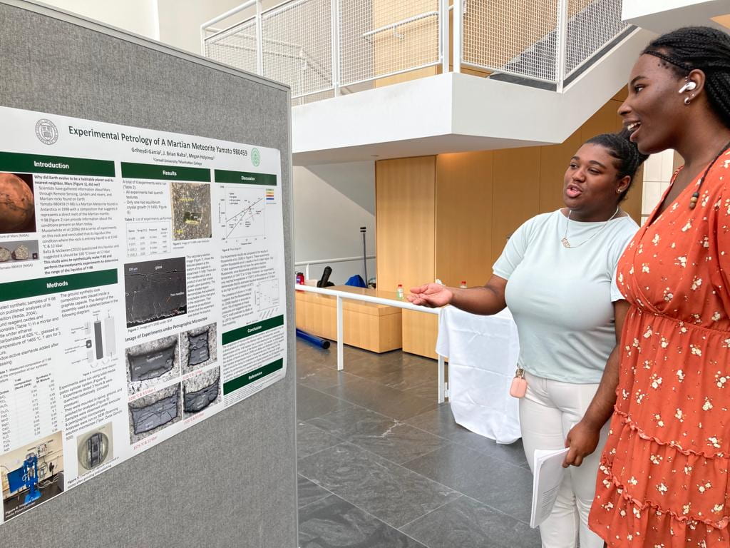
TITLE: Experimental Petrology of A Martian Meteorite Yamato 980459
Student: Griheydi Garcia; Advisors: Drs. Megan Holycross and Brian Balta
 ABSTRACT
Martian meteorites are the only samples that we have from the Red Planet, Mars. These meteorites have provided us with different clues on how the Red Planet formed, behaves, and ultimately, why we haven’t found evidence of life there today. Yamato-980459 is a basaltic Martian meteorite found in Antarctica in 1998 with a composition that suggests it may approximate a direct melt of the Martian mantle, and thus its composition can give us information about the conditions that are present inside Mars today. Previous experiments by Musselwhite et al. (2006) concluded the liquidus (condition where the rock is fully liquid) of Yamato-980459 at 12 Kbar is 1540 °C – a very high temperature compared to similar compositions on Earth and higher than predicted by the most used geochemical modeling software. We ran piston-cylinder experiments at 9.5 and 12 kbar to independently determine the position of the Yamato-980459 liquidus. Results from these experiments suggest that the temperature of Yamato-980459 liquidus is <1520 °C at 12 kbar, slightly different from the result of Musselwhite et al. 2006 but close enough to indicate that their liquidus was approximately correct to within ~10s of degrees. These experiments thus replicate those from the literature and demonstrate that the previous results are accurate to within a small margin of error. Musselwhite also concluded that this rock may originate from a primary magma, which further prompts us to understand how such high temperature magmas form within the last few hundred million years on Mars, which was predicted to have a much colder interior today due to cooling over geologic time. It also brings up other questions: What are the exact conditions of the parent magma of this rock? Can the new missions from NASA find rocks with the same bulk composition as this rock and give context for where these rocks are found on Mars?